Monday 25 June 2012

HONDURAS


HONDURAS COPAN
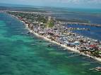
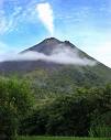
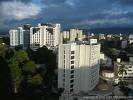
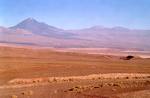
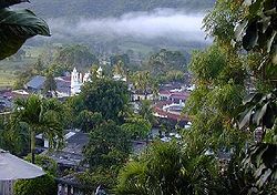
Honduras and its people are poor but their history is rich. It is situated north of Nicaragua and has the Caribbean Sea with the Gulf of Honduras on one side and the Pacific Ocean with the Gulf of Fonseca on the other. On the Pacific coast, which is short, the country is rugged and often inhospitable. On the Caribbean side the country is long, low-lying. The climate is hot and steamy by the sea but cooler in the hills. The population live mostly in the hills.
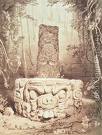
MAYA TEMPLE

MAYA BUILDING
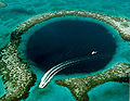
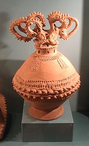
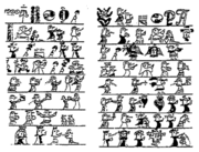
By the western town of Copan are the remains of Mayan city which was built around 500 AD. This ancient city has a ruin of a Ball Court. It is believed that there were ceremonial games which were similar to the Greek Olympics. An archaeological dig around the Main Court stela (carved column) at the Mayan ruins of Copan is hoping to find more answers. The Mayan Empire had its height between 200 AD and 900 AD. It still existed till the Spaniards arrived in the 16th century.
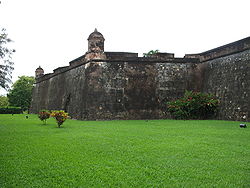
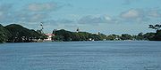
FORT BUILT BY THE 
SPANISH TO KEEP THE 
ENGLISH PIRATES OUT
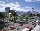
Honduras won their independence in 1821. This followed a succession of unstable government. In 1969 the so called 'Soccer War' broke out against El Salvador. It followed an explosion of violence at a football match between the two countries and went out of control. The war, which followed, was about a border dispute and finished officially in 1980. After that Honduras became more stable but in the remote north-east the Nicaraguan guerrillas used it in their war against the Sandinistas. The economy was improved by Foreign aid via the World Bank.
In the past, Honduras was the biggest exporter of bananas. Nowadays, it still exporting great amount of bananas but they also export coffee, beef of large quantities, as well as pine, oak and valuable mahogany. These woods still cover large amounts of the mountains.
In comparison to the neighbouring El Salvador; Honduras is five times as big and has the same number of people as El Salvador. The people are descendant from Indians and Spaniards but the ruling class are pure Spanish.
Hondurans grow maize and beans for their own consumption and live in houses made of mud and wattle. A few factories making soap and cigarettes for their own use. They mainly trade with the US and US companies own the plantation and the mining operation. The plantations on the Caribbean coast have black workers who are descendant of African Slaves.
Most of the industry and government were under foreign control. The top company of foreign-owned companies was United Fruit Company and it was owned by the USA. 1954 the workers went on strike and better conditions as well as less power of the Americans was achieved. Nowadays, the foreign influence still exists but more power is now in the hands of the Hondurans.
Top of Form
Bottom of Form
Top of Form
Bottom of Form

Tuesday 19 June 2012

EL SALVADOR


EL SALVADOR CITY
EL SALVADOR -- 
JIBOA VALLEY AND 
SAND VINCENTO VOLCANO
El Salvador was almost destroyed by civil war which lasted for 12 year. Now it slowly rebuilt itself with foreign aid and the famous coffee.
When the Spanish tried to conquer El Salvador the inhabitants of the western part of El Salvador drove them out. The inhabitants at the time were the Pipil and they called that part of the country Cuzcation which means 'the land of precious things'.
Pedro de Alvarado attack from Guatemala in 1524 but was unsuccessful. He tried again in 1526 and was beaten back. In 1528 he succeeded. 

The Spaniards founded the city in El Salvador at a place called Ciudad Vieja. It was occupied from 1528 till 1545 and then abandoned. A new city was established where El Salvador city is today.
It was part of the Spanish empire and one of their colonies until El Salvador became independent in 1821. After that its rulers were one dictatorial presidents after another and with it their military juntas (councils).

The people revolted because of poverty and repression and it was the start of a bloody civil war which lasted from 1979 to 1992. The shadowy death squads killed many thousands of civilians. 


Eventually elections were held after a ceasefire was declared by the rebellious FMLN. The country tries now to establish a certain amount of stability.

El Salvador lies on the Pacific side of Central America. It borders on Honduras and Guatemala on the south. It is a small country and is hot and humid on the coast. Towards the inland it is getting cooler. It has two long chains of volcanoes. One volcano which towers above San Salvador is still active and erupted in 1917. In the west is Mount Izalco and it is the most active volcano. It has been nicknamed the 'Lighthouse of the Pacific' because in 19th century, sailors set their course to the continuous glow from its summit.
As if that is not enough it is also in the earthquake zone. The modern building in San Salvador has many low buildings designed to withstand earthquakes.
Since the land has been too much cultivated, the soil is very poor. Only small sections of the original forest has been left but in spite of all this a big wildlife remains; such as monkeys, jaguars, tapirs, many kind of birds, reptiles and fish.
El Salvador is the most overpopulated country in Central America. Therefore, poverty is widespread. The people are descendants from Indians and Spaniards and called Mestizos. They are surviving on basic agriculture. The country main export is coffee and its economy depends almost totally on it.


SAN  SALVADOR

Sunday 17 June 2012

BELIZE


BELIZE
Two main cities are in Belize. One is Belmopan in the centre of Belize. The other cities are Belize City. The capital of Belize is Belmopan but it has only a population of 4000. Belize City has 50,000 and lies on the coast. Belize was formerly called British Honduras until the Independence in 1981.
Dating back to the early 1600, Belize City was built at the mouth of the Belize River because of the logwood forests inland. The textile industry used the logwood for dyes. The demand for logwood remained till 19th century. After that coal tar dyes were used because it was cheaper. Nowadays, their export is timber for furniture, sugar, citrus, fruits, bananas and lobsters which boost the country's economy.
BELIZE BARRIER REEF

Off the coast of Belize are many small coral islands. They are called cayes (or keys) and have the second longest coral barrier reef in the world, after Australia's Great Barrier Reef. The country is low-lying with thick forest and mangrove swamps. The Maya mountains are in the south.
The population is from African slaves brought over by white settlers to work in the forests. There is also a big population of Spanish-American and a minority of Mayan Indian.
In 1923 a manually operated swing bridge was built in Liverpool, England and installed over the Haulover Creek in Belize City. This bridge is operated twice a day to enable boats passing along the Creek.
They are building 'dream holiday' cottages by idyllic beaches to develop the tourist trade. These cottages, beaches and the many ancient Mayan Indian sites in the interior seemed to attract tourism.

HIGH TEMPLE 
NEAR LAMANAI

British troops were stationed there after Belize gained independence in 1981. However, as the relations with the neighbouring country of Guatemala improved, the British troops withdrew.


GREAT BIG HOLE NEAR AMBERGRISS CAYO
http://www.awltovhc.com/image-2103840-5902068


Saturday 16 June 2012

COSTA RICA


COST RICE - CAPITAL -- SAN JOSE
Costa Rica borders on one side on Panama and the other on Nicaragua. It is between the Caribbean Sea and Pacific Ocean with the Gulf of Nicoya. It is most properly the most peaceful country in Central America; it has no army.

HISTORY
Before the Spanish conquest, Costa Rica indigenous people were the Nahuati who lived in the north-west of the country. The Chibcha lived in the central and southern country. However, after the Spaniards invaded, they either died of smallpox or of ill-treatment from the Spaniard.
Since Costa Rico was not on a trade route, it was ignored by the Spanish monarch. This enabled the Costa Ricans to develop in peace and quietness.  Another problem contribute to the situation was that the indigenous people almost died out and the Spaniard had no labour force like in the other colonies.
NATIONAL THEATRE
COSTA RICA BEACH

PRE-HISTORIC 
INCENSE BURNER 
WITH CROCODILES' HEADS

Since the country received its independence from Spain in 1821 and has then a long history of stable, democratically elected government ever since.
After 1821 Costa Rica became part of the Mexican Empire for a short while.  Then it joined the Federal Republic of Central America from 1823 till 1839.  Although it joined the Federal Republic, disputes broke out about borders and Costa Rica entered into another turbulent time.
In 1838 Costa Rica withdrew its membership and proclaimed it sovereign.
However a civil war did break out in 1948 and there were 2000 dead and it lasted 44 days.  After that the people decided they did not want anymore blood-shed and done away with the army. Ever since Costa Rica is the most peaceful country in the world.
JUNGLE

Costa Rica has a swampy, tropical area on the coast which has an enormous exotic wildlife with inaccessible forests. Right through the middle of the country runs a mountain range with high plateaus which also includes several volcanoes with a height of over 3500m.
These central highlands are called meseta central and are cooler than the plains. The plains are very fertile and most of the population live there. The capital is San Jose and built in the meseta. The city Cartago, which is closed by, used to be the capital of the country during the Spanish occupation.
The country has famous wildlife conservation and dedicated 11 % of the country to a national park. A total of 27 % of the country have some form of protection which includes monkeys, sloths and sea turtles. Rare species of jaguars, tapirs and harpy eagles can be found in these areas.
The population consists of mestizo (of mixed race) or white. The remaining 6000 Indians live mostly in the mountains. There are a small number of black people which are descended from African slave and live near the coastal area.
Schools are free and Costa Rica spends most of its budget on education.
COFFEE PLANTATION
ECONOMY
They have a booming tourist industry. The mining and food processing are growing but the main economy is still agricultural. Coffee and bananas, which grow very well on the volcanic soil, are their main export. Farmers there owe their own land and work on it themselves.

COSTA RICA -- VOLCANO

COSTA RICA IS A SHINING EXAMPLE ESPECIALLY FOR CENTRAL AND SOUTH AMERICA BUT ALSO FOR THE WHOLE WORLD. IT PROSPERS BECAUSE IT HAS NO ARMY AND DOES NOT GET INVOLVE IN WAR.

Friday 15 June 2012

COLOMBIA


                     BOGOTA GOVERNMENT BUILDINGS                                 
Colombia and its people received a bad reputation because of a history of drug trafficking. Yet it is such a beautiful and richly endowed country. It could have so much more than a bad reputation of drug trafficking and lawlessness.

BOGOTA FINANCIAL C ENTRE

HISTORY
The area which is now known as Colombia was inhabited by indigenous people such as Musca, Quimbaya and Tairona.
10,000 BC hunters/gatherers lived alongside what is now Bogota and traded with one another. At the beginning of the first millennium BC, groups of American Indians started to have a political system 'capicazgos' with a pyramidical structure and headed by a Caciques.
The Taironas were living in the Caribbean Region and Muiscas were living in the highlands around Bogota. They had the most complex capicazgos structure and spoke the Chibch language.  The Muiscas had the most political structure after the Incas.

CARTEGENS DE INDIAS

LES LEJOS CATHEDRAL IN NARINO

CHICAMACHA CANNON

THE WAYUU REPRESENTS THE LARGEST GROUP OF THE INDIGENOUS PEOPLE..

The American Indians, the Chibcha tribe, lived near Bogota. They lived for more than 6000 years there and were great craftsmen. They made magnificent jewelleries from gold, silver and emeralds.
THE ZIPA USED TO COVER HIS BODY WITH GOLD.

The Zipa used to covered his body in gold, and from his raft, offered the treasures to the Goddess Guatavita in the middle of the lake. That could have, most properly did, spark off the legendary city of El Dorado.
When the Spaniards arrived in 1499 they heard about the fabulous city of El Dorado. They never found it. However, they wiped out many Indian tribes in trying to find it. Bogota was founded in 1538 by a Spanish soldier of fortune. His name was Gonzalo Jimenez de Quesada. Most Colombians are a mixture of Spaniards and Indians. The black people living on the north coast. There are still 300,000 Indians but they are living in the forests as they done for centuries.
In 1819 Simon Bolivar defeated the Spaniards and the British forces and liberated Colombia. However, till 1903 they had about 70 civil wars. After Panama broke away from Colombia, it experienced a time of peace in spite of social unrest and military rule on and off. After 1948 there was constant class warfare for 20 years. In 1966 it ended with the presidency of Lleras Restrepo.

ECONOMY
The cocaine trade is undermining the country's security greatly. These groups (cartels) have great power and defy the government. In the mid 1990s the government won back the control after crushing cartels in the cities of Medellin and Cali.
Colombia is blessed with coastline on both sides of the country, the Atlantic and Pacific. It is twice the size of France. The land is so rich and has such a variety. It has three ranges of the Andes Mountains. The Western, Central and Eastern Cordilleras are along the north-western side of the country. In the centre it has a grassy plateaux called the Ilanos. The rain-sodden plains which are covered with tropical rainforest called the Selva are in the south and eastern side.
The hardly inhabited rainforests is full of wildlife such as pumas, jaguars, sloths and armadillos. It also contains rubber trees, balsam wood, mahogany and tropical plants which are used for medical purposes. In the west where the highest mountains peaks are, is the home of the condor. The mountains also serve as a resting place for 1500 species of birds when they are on their migration.
Colombia is known for an export of high quality coffee which is grown on huge plantations. The poor farmers, however, with little land, grow coca plants to sell the leaves. These leaves are processed into the illegal drug cocaine and secretly shipped out which makes a lot of money. Cocaine makes twice as much money for the country as coffee. Citrus fruit, bananas and mangoes are also grown there and exported.
Colombia also has the world most beautiful emeralds. Platinum is another commodity being exported. They have mines of gold, silver, copper, coal, iron and nickel. Oil and gas has been found near the border with Ecuador. They have one problem with transporting the ore through rugged terrain. They used the Magdalena River for many years but roads are being built.
MAGDALENA RIVER

Thursday 14 June 2012

GUATEMALA

GUATEMALA CITY

Guatemala and its people and history had and have a very turbulent time. The country lies the furthest north of all the Central American countries. As beautiful and intriguing it is; it has a terrible reputation. It made a name for itself for strong coffee and sudden death but not from coffee.
In the north of Guatemala is a vast tropical forest and it is called Peten. The south has a densely population highland region and is dominated by Sierra Madre which are volcanic mountains.
Until the Spaniards arrived in 16th century, Guatemala was part of the vast Maya Indian Empire. In the forest are remains of cities the Maya Indians built 2000 years ago.
Not many people live there now but the dense vegetation has many animals. The most famous is the quetzal which is a rare bird with bronze-green plumage and a tail up to 90 cm long. It is Guatemala's national emblem and the country's unit of currency is named after it.
In the country two recognized races exist. One is the Indians and the other is the mestizos. These are of mixed Spanish and Indian ancestry and some of pure Spanish descent. The Indians live in the mountains growing maize and vegetables on steep and harsh hillsides. The families move to the central highlands for some time in the year, to earn extra cash. They work on coffee, cotton, and tobacco plantations. In the coastal lowland are sugar cane, bananas and pineapples cultivated and harvested.
The capital Guatemala City is the largest in Central America. It has a population of nearly one million. The original capital Antigua was destroyed by an earthquake and after that the Guatemala City was built. Unfortunately, it was twice destroy by an earthquake in 1917 and 1976.
After the independence in 1821, Guatemala was ruled by dictators until recently. However, many people still work for low wages and can't read and write. The military has the real power and the people who ask for reform draw attention from the 'death squads’. They are undercover assassins working for the police and army.
GUATEMALA CITY
GUATEMALA CITY BY NIGHT

TIKAY MAYA RUIN

Wednesday 13 June 2012

CHILE


SANTIAGO
The people of Chile live in the second smallest country in South America and it has a tremendous history. The country is narrow and long.   It is never wider than 350km and is 4350km long. It has a long coastline at the Pacific Ocean. In the North it borders on Peru. On the eastern side are the Andes, all along, making a natural boarder to Bolivia and Argentina. On the western side, Chile has a long coastline and access to the ocean.
The Bio Bio is Chile most important river. It cuts through the coastal range to the sea.
Chile has three extreme climates. In the North it is dry and arid. In the centre it has Mediterranean     climate and in the south it is wet and stormy.

ATACAMA DESERT

The Atacama Desert, apparently, is the driest place on earth. Some area has never seen a drop of rain since record began. It was formed 150 million years ago and is the oldest desert on earth.  Another interesting point, scientist discovered that the surface boulders never moved for the last 23 million years. Astronomers often take advantage of the clear sky for their star spotting.
PARNACO VOLCANO 
IN THE NORTH


CONGUILLIO 
NAGTIONAL PARK 
IN THE SOUTH CENTRAL 
OF CHILE

EASTER ISLAND

GREY GLACIER 
IN THE SOUTH

The Andes' highest peaks are over 6000m. The northern Andes are a high, dry plateau. The highest peak called Ojos del Salado is 6879m and is in the centre. The south has many lakes and ffords and also 50 out of 2000 volcanoes are still active.
The wildlife in the north is llamas, vicunas, guanacos and alpacas. The last reserves of the chinchilla are found in the mountains. Also Andean puma, eagles and condor are at home there. A huge amount of plants, insects and animals are in the centre. Further south, in the wet regions, animals and birds are threatened by deforestation of the rainforest.
On the coast is dolphin and further south are sea elephants. South of Tierra del Fuego towards the Antarctica the seas are full of krill. These are necessary for the baleen whales.
The Spaniards brought the horses into the country and are now an important part on the cattle estates called estancias.
Punta Arenas is the most southern city in the word. Temperatures rarely go above 10oC and it is very windy. It is an oil production centre.
The island Tierra del Fuego is south of the mainland and belongs to Argentina and Chile. The inhabitants were farmers until the oil was discovered.
In the north of the country are the world's largest deposits of copper. There are also other minerals like lithium, gold, silver, coal and iron ore. Gas and oil are found in the south. Chile harvests its power from hydroelectric and thermal plants. The economy is based on the mineral resources and an established manufacturing base for wood pulp and fish meal.
Chile's annual fishing is the highest in the world because of the Humboldt current in Peru. Only 10% of the land is cultivated and mostly in the central region. They grow mainly cereal, sugar-beet, grapes for the wine industry and fruit. The pasture in the hills is for sheep and cattle grazing. The Lake District is for traditional farming and cattle rearing. The rainforests provide timber.
THE ORIGINAL 
MAPUCHE INDIANS

The people are mostly of mixed blood - Indians/Spaniards. A small group of Mapuche Indians are still living in Temuco. There are also Slavs, Arabs, Italians and Jews living in Chile.
Chile has a good social security system and it is privately run. The health system has improved so much that it has the highest life expectancy in South America. The population is the highest educated. Two international poets, Pablo Neruda and Gabriela Mistral are Nobel prizewinners.

HISTORY
10,000 years ago the Native Americans migrated and settle what is today's Chile. Evidence proves that there were settlements at Cueve del Milodeon and Pali Aike Crater's lava tube. The Incas tried to move into North Chile but the Mapudie beat them back. They fought Sapa Inca Tupac Yupanqui and his army. A three days battle wich is known as the Battle of the Maule. The Incas conquest of the territory ended at the river Maule.
A century before the Spaniards conquered Chile; Incas made their way to central Chile. When the Spaniard, Pizarro, invaded their empire and destroyed it.
The first attempt for independents was made at the beginning of the 19th century when France invaded Spain. In 1817 Chile defeated the Spaniards. After that the country was ruled by a constitutional oligarchy until the early 29th century. The population demanded a democratically elected government.
In 1970 the first elected Marxist leader, SalvadoreAllende, became president. He nationalized the US-owned copper mines and America answered it with a boycott. This brought hardship to the country.
General Pinochet led a military coup and overthrew Allende. Pinochet suppressed all opposition and a referendum in 1988 reject the military regime. Democracy returned and the country returned to civilian rule.
CAPE HORN WITH ITS STRONG CURRENT, STRONG WIND AND ICEBERGS -- IT WAS DREADED BY SAILORS

Sunday 10 June 2012

HAITI


HAITI 2004 FLOOD
Haiti and its people are the poorest amongst South America.

Its history made many times world headlines.

Furthermore, natural disasters devastating
the country and its economy


HAITI -- BAS-RAVINE
IN THE NORTHERN
PART OF CAP HAITIEN 
HAITI MANGROVEFORES


HISTORY
A PICTOGRAPH
TELLING THE STORY
OF MISSIONAIRIES
 ARRIVING IN HISPANIONLA
IN 1510

In 1791 a Haiti revolution was against the French rulers. One of the famous leaders was Toussait l'Ouverture. In 1804 Haiti became independent and was the first black republic in the world. 


JEAN JACQUES DESSOLINE LEADER OF THE REVOLUTION AND FIRST RULER OF INDEPENDENT HAITI

In 1915 the USA moved in and  occupied it till 1934.
Most of the country's rulers were dictators. The most gruel dictators were 'Papa Doc' and 'Baby Doc' Duvalier yet the USA supported them both. 
Recently there were moves towards democracy and Jean-Bertrand Aristide was elected in 1991 as president. However, he was soon ousted by the military after a few months. The USA intervened and he was reinstated in 1994.

COUNTRY 
The land is shaped as a horse-shoe and on the western side of the Hispaniola in the Caribbean. Haiti is a poor country and many times connected with voodoo drums and cruel dictators.

It is the third of the Hispaniola island and borders onto the Dominica Republic.

The landscape is rugged and covered with tense, tropical forests. These forests contain tree-ferns and bamboo with wildlife of lizards, flamingos and crocodiles.
The tropical forests had been cut down to make way for farming but it resulted into the soil being washed away by heavy rain which resulted into further greater poverty.

ECONOMY
The export is sugar, coffee and sisal. The farmers can grow only enough food to feed their family. To increase their income, they cross the border into the Dominican Republic to cut sugar can.

They also emigrate because the life is so harsh. The few industries which exist are sugar mills and a major export of baseballs.
The people are descended from African slaves who were brought over by the French colonists. French is widely spoken and so is Creole which is an Afro-Caribbean language with many French words.

Their religion is mostly Roman Catholics but voodoo which is an African-based religion is practised. Haiti art and literature is different from the other countries.